")


")

Weather Takes Another Swing
After unseasonably warm day, Jefferson County sees more wide spread flooding.
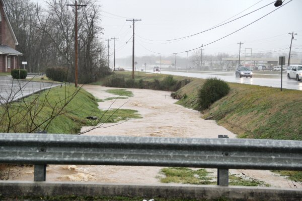
New Market, Tennessee approximately 1:00 pm Wednesday afternoon. – Staff Photo by Jeff Depew
Jefferson County residents have been hit with a plethora of strange weather swings this Winter and the trend looks to continue into the first week of February. Last week’s ice has turned into yesterday’s storms and looks to make another transformation into possible snow flurries. Not only has the precipitation had difficulty determining which form it would take, literally dumping rain on the area for days on end before bringing snow and eventually ice to the region, but the temperatures are having equal difficulty in picking a season. Spring like temperatures early this week followed a cold snap that coincided with the ice storm that had much of Jefferson County homebound last week. Temperatures are expected to, once again, plummet in the same teeter totter fashion that has been the norm this Winter. The National Climate Prediction Center is calling for relatively normal temperature and precipitation during the second month of the year, however, that forecast is conflicting with the forecast for the first two weeks in February which anticipates above average temperatures for much of the United States, including the local area, and above average precipitation. Long term prediction through the Summer of 2013 calls for above average temperatures and normal precipitation, with the heat wave not lifting until Fall. The prediction of another sweltering Summer could make the ups and downs of Winter more bearable for locals looking for a quick end to the intermittent frosty days. In actuality, Winter is only half way complete and there promises to be many more days of up and down weather before Spring truly emerges in the area.